Last modified 27 July 2006 19:25 Eastern Time
Saturday, we left Oban and headed south.
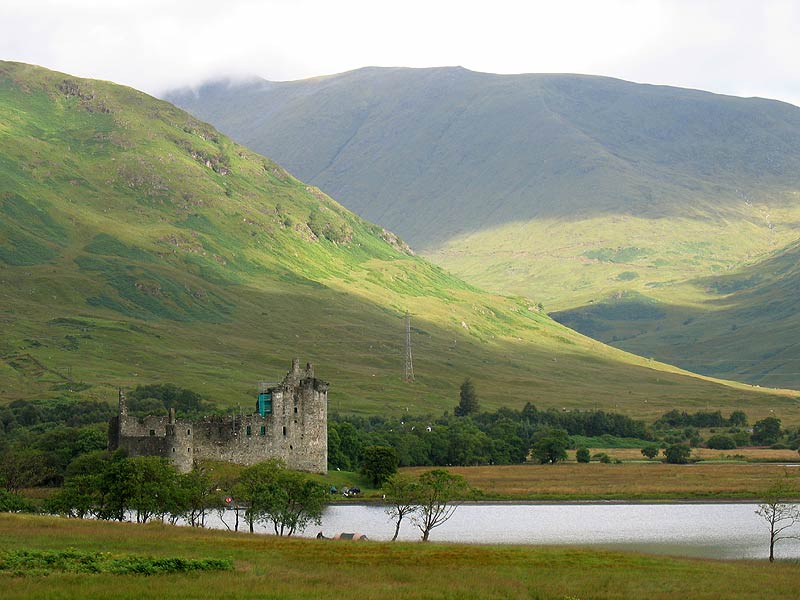
| At one place, we stopped for a rest. I got this picture of a castle being worked on amid large hills. If they get this castle up to spec, they’ll clearly have power available for it. Right now, it looks like a shell. | |
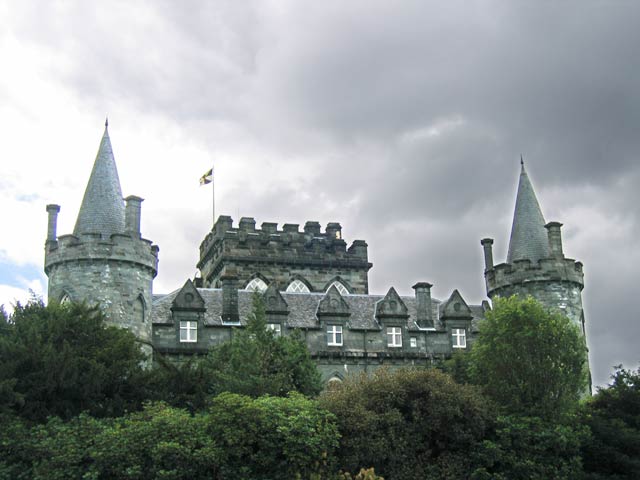 |
Next, we got to Inverary Castle, the home of the Duke of Argyll. No occupied castle, including this one, allowed pictures inside, so I haven’t any. Inverary had a large display of old firearms (read: muskets) which we were told had been taken out a few years earlier for cleaning and testing. Many of them still worked! Woohoo! We didn’t see the Duke. I forget if there was a picture of the 8th Duke in the places we toured. I rather doubt it. |
| They had this fairly nice flower basket. | 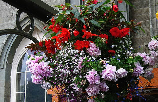 |
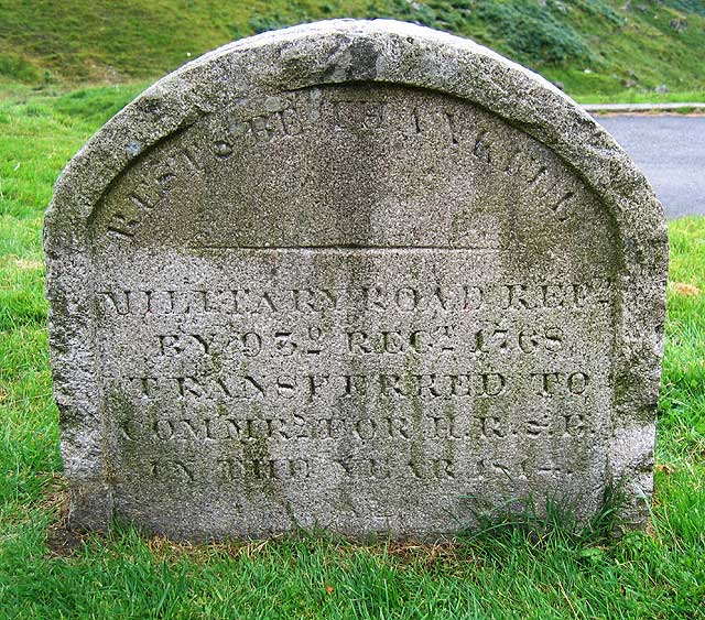
At “The Rest", we encountered this sign:
At the top of Glen Croe is the mountain pass known in Argyll as ‘The Rest'. Here, in 1748, the detachment of soldiers responsible for building the old road erected a stone, inscribed as follows: REST, AND BE THANKFULTHIS ROAD WAS MADE, IN 1748 BY THE 24the REGIMENT LORD ANCRAM, COLONEL DUROURE, MAJOR REPAIRED BY THE 93rd REGIMENT, 1768 This stone disappeared, and was replaced by the present round-headed granite headstone when responsibility for the upkeep of roads and bridges in the Highlands was transferred to the Commissioners for Highland Roads and Bridges, in 1814. Boswell and Dr. Johnston paused for breath here in 1773. The weather wasn’t very kind to them: “The weather was tempestuous ... the wind was loud, the rain was heavy, and the whistling of the blast, the fall of the shower, the rush of the cataracts (waterfalls), and the roar of the torrent, made a nobler chorus of the rough musick of nature than it had ever been my chance to hear before.” They, and their Highland ponies, must have been glad of the rest. Of course they travelled by the old road, part of a network of roads and bridges built after the Jacobite rising of 1745-46 by General Wade and General Caulfield. They transformed the Highlands, and as well as making the region more easily pacified by Government forces, made it accessible to tourists for the first time. Dr Johnson’s [sic] unequalled prose makes it clear he appreciated the efforts of the roadbuilders: “We proceeded over Clencroe, a black and dreary region, now made easily passable by a military road, which rises from either end of the glen by an acclivity not dangerously steep, but sufficiently laborious.” We can almost hear him puffing! Surely he had to walk at least up the steepest sections of the road, as even the hardy Highland garrons would have struggled under his considerable bulk. Travelling over the same route in 1800, John Stoddart saw Glen Croe as “as scene of savage magnificence", with “bold rocky mountains which shoot up to the clouds, and approach so close, as to imprison you between their folds.” We think you will be impressed too. Have you ever wondered just why the landscape of Argyll looks so beautiful and ‘scenic'? The answer is glaciation — ice; ice on the Scotch rocks. From this viewpoint you can admire the ice-carved valley of Glen Croe on one side, and the classic U-shaped Glenkinglas on the other. One of the early geologists who first worked out how this landscape was formed was John MacCulloch, who visited Cowal between 1811 and 1821. While the land today looks much the same, we disagree with his assessment: “Nor need a traveller cross any of the hill roads which lead between Gare Loch, Loch Long, Loch Goyl, Loch Eck and Inverary. In general, they offer no scenery to compensate for their inconvenience, since many of them are scarcely fit, even for pony roads. Even the most arduous and ambitious tourist may abandon the whole of this interior mountain tract of Cowal without regret.” Since the “pony roads” are vastly improved, we hope you will take the chance to decide for yourself! Here at ‘The Rest', is where your exploration of Cowal really begins. You can take the B828 south to Lochgoilhead, which lies, as you may already have guessed, at the head of Loch Goil. There, you can enjoy water sports of all kinds, view the beautiful coastal scenery, explore the ruins of Carrick Castle, and walk — or ride on horseback — in the surrounding hills and forests, before returning through Hell’s Glen to the shoreline of Loch Fyne. |
Discovering COWAL Discover the history of the Cowal Peninsula with the help of the panels and leaflet, which you can pick-up at the nearest tourist centre. You can follow the routes shown below and you will find more panels like this to help you find out more about the Cowal Peninsula.
|
Or, you can continue along the A83, past Loch Restil (Gaelic loch ros teile, ‘the loch of the point of the lime trees'). maybe the soldiers thought of calling this spot Rest and Be Thankful after they found out the name of this lochan — squaddies have always been able to come up with a joke in adverse conditions. Above Loch Restil are the crags of Beinn an Lochain (901m; 2985 ft). There’s a large cairn on top built to try to turn it into a ‘Munro’ (mountains over 3000 ft), but purists say that doesn’t really count. As you descend into Glenkinglas and pass the old Wade Bridge at Butterbridge, you will see the slopes of Beinn Donich (847m; 2772 ft) up on your left. Near the end of a long, fast, straight stretch of road (take care) is the junction with the Dunoon road, and another point of entry into Cowal. Many famous travellers have passed this way. William Wordsworth set the trend for a generation of 19th century travellers looking nostalgically for a romantic Scotland which perhaps existed only in his mind: "Doubling and doubling with laborious walk, There’s lots to do and lots to see in Cowal — why not follow our Discovery Trail and let us guide you around this beautiful area? This wonderful countryside at any season of the year — come again and again, and enjoy the subtle alterations of light throughout the year in the changing landscapes. To Discover Cowal, turn off the A83 here and head for Lochgoilhead, or alternatively turn off at the Dunoon road end, and enter Cowal that way. Look out for the next information point on this Discovery Trail in the village of Cairndow, a mile past the Dunoon road end, on the shores of Loch Fyne. When you cross ‘The Rest’ you will really begin to feel that you are in Argyll, the lands of the Gael, with separate histories and traditions to the rest of Scotland. Argyll was settled by Gaelic-speaking peoples from the Antrim coast of Northern Ireland around 300AD, and Cowal was part of their kingdom of Dalriada. The Romans had called these peoples Scotti, and this is how they became known when some of them moved across to Argyll. By 843AD these Gaelic settlers had established themselves securely up and down the west coast, and crossed the mountains into the eastern half of the country, where their king, Kenneth MacAlpin, married a Pictish princess and established the united kingdom of Picts and Scots which eventually became the land we call Scotland. As well as bringing political and social unity, they also brought Christianity. St Ninian and St Mungo had previously travelled among the Pics as missionaries early in the 5th century, but when St Columba, or Colum Cille, established an abbey on the island of Iona in 563AD, this was the beginning of a period of missionary zeal and expansion which eventually spread the new religion all over the country, replacing the native pagan practices. As you travel through Cowal, and other parts of Argyll, you will find many reminders of these early travellers, so spare a thought for them as you follow in their footsteps. |
 |
Here’s the replacement marker the sign was referring to, a little ways away. |
| Of course, with instructions like that, who are we to do anything but obey? I expect that’s one reason we stopped there. These people even had lunch. Given that there are picnic tables near the marker, that seems to be the idea. | 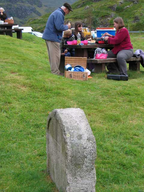 |
After lunch, the idea of adding in a trip to Stirling Castle was aired. We voted for it. As a result, we had next to no time at Loch Lomond. I have no pictures there.
Once at Stirling Castle, we found a statue of Robert the Bruce, and posed for a group portrait. I don’t know what happened to that, unfortunately. I don’t have it. I got a few shots of the statue on its pedestal, but nothing worth posting.
I took an individual picture of each person in our group. I’m not posting them, as I don’t feel it’s appropriate and I don’t have release forms. I think I got everyone, but I’m not sure.
| Wandering around Stirling Castle, I got several pictures, mostly of signs so I could read them later. The rest of the pictures are generally uninteresting snapshots. However, I do like this one. | 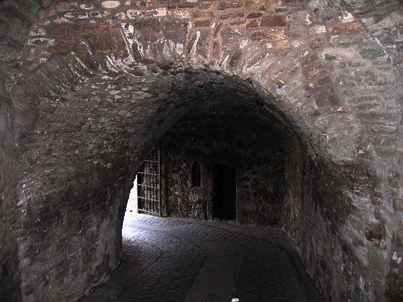 |
And that’s the end of the tour. We spent that night at a hotel near Glasgow in which there was a wedding. There were lots of people dressed in formal Scottish clothing, and they looked good. If I hadn’t been tired, I might have stayed up and found out what “drunken Scotsman” means. ;-)
But I had one more day in Glasgow by myself...